Providing Information Services for Disaster Prevention and Mitigation
OYO Corporation
| Publication date | August 20, 2021 (Posted on March 30, 2023) |
|---|---|
| Sector | Natural Disasters / Coastal Areas |
Company Overview
OYO Corporation and OYO Corporation Group use a wide range of expertise and technologies in all aspects of earth science to survey the properties of land and the nature/characteristics of groundwater, natural phenomena, and disasters. We also predict and evaluate the impact of these phenomena on business and society, and make optimal proposals for solving various issues related to earth science. Currently, we are extending our business by focusing on four segments: Infrastructure Maintenance, Management, and Renovation, Natural Disaster Prevention and Mitigation, Environment, Natural Resources and Energy which are designed to balance human and nature, and support safety and security through technology.
Climate Change Impacts
According to the data from the Cabinet Office, more than 97% of municipalities experienced flood and landslide disasters in the 10 years between 2008 and 2017. In addition to the occurrence of heavy rains and torrential rains due to climate change, urbanization is said to be one of the reasons behind the increased risk of floods and landslides. Urbanization has led to the development of drainage systems that allow large amounts of rainwater to flow into rivers in a short period of time, and has also led to the development of potentially disaster-prone land into residential areas.
Adaptation Initiatives
OYO Corporation provides a comprehensive range of services for disaster prevention and mitigation, from surveys, analyses, predictions, diagnosis, evaluations and countermeasures for natural disaster risk. Examples of these services are below:
- Flood risk report: We collect and organize the data provided by the national and local governments, such as flood and storm surge inundation, estimated flooding due to rainwater runoff (inland water), and hazard maps, and provide flood risk information in an report format that is easy to understand.
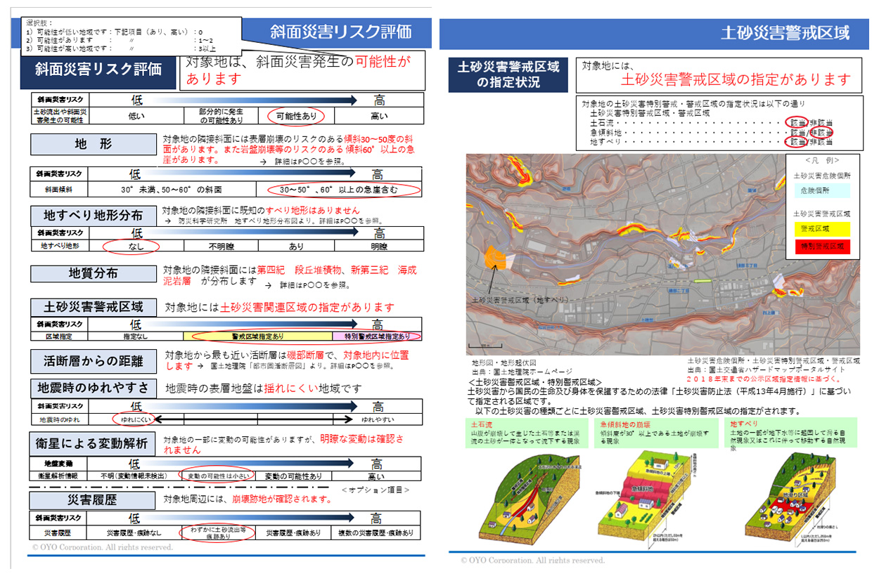
- Slope risk report: We conduct a simple diagnosis of slope risk level within the project site and promptly provide information on the risk of slope failure (Figure 1).
- Watershed and flood control services: We provide total flood prevention solutions, from the designing of river management facility enhancements to the installation of monitoring systems and software to facilitate evacuation, in order to help secure the safety of local communities from the threat of torrential rainfall disasters.
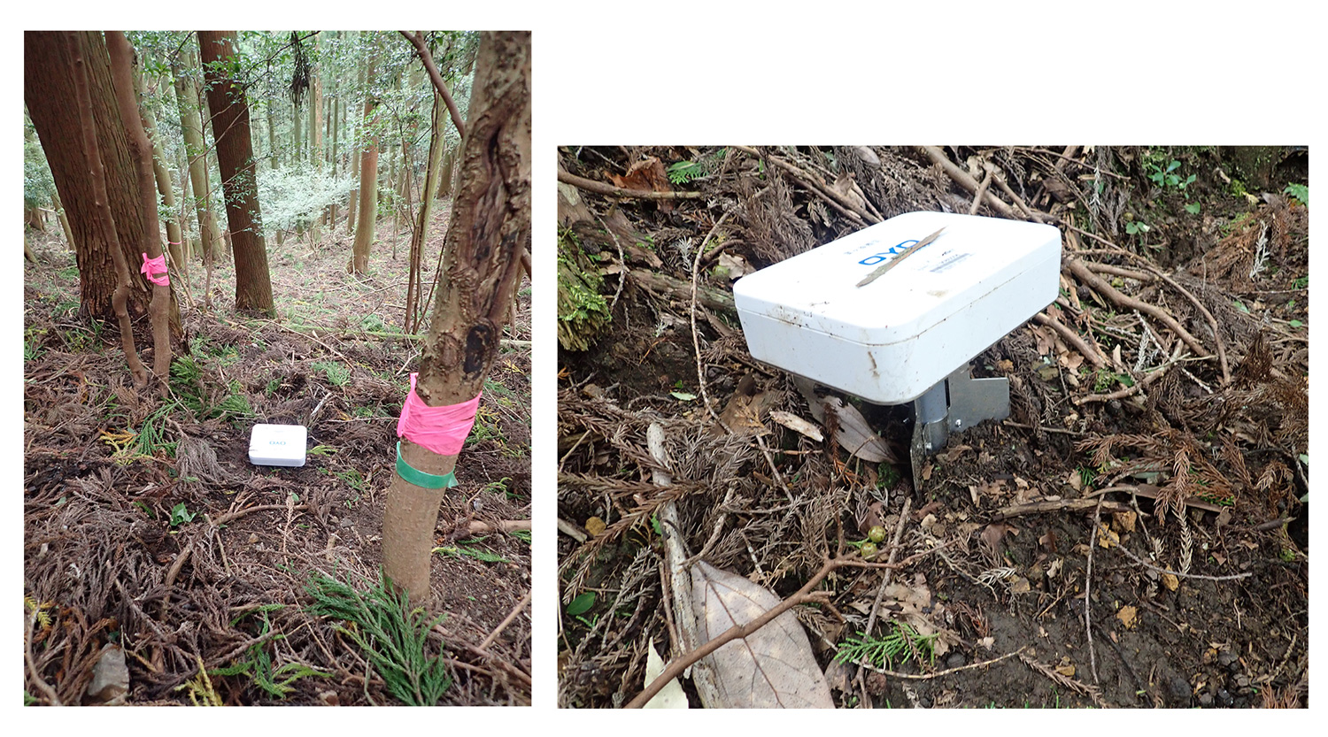
- Landslide and slope failure countermeasure services: We offer a wide range of solutions, including geological surveys and designing of countermeasures for slopes with the risk of collapsing, development of landslide disaster monitoring sensors, design/inspection/quality investigation of erosion control facilities, and development of landslide disaster evacuation support systems suitable for "zero evacuation delay" initiatives in the occurrence of a disaster.
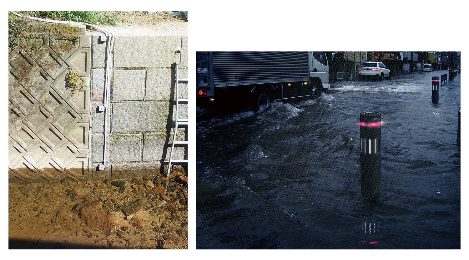
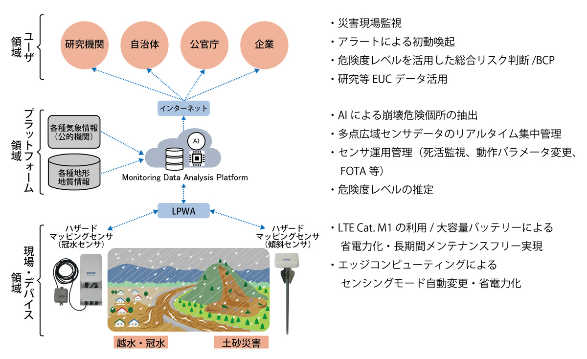
- Hazard mapping sensor solution system: This system consists of multi-point disaster prevention sensors based on edge computing, LPWA, and IoT/cloud (Figures 2 and 3). It also has a detection function to locate the sensors using AI (artificial intelligence), which incorporates our extensive expertise from our geological surveys and disaster prevention/mitigation business over the years. The system enables multi-point/multi-dimensional/wide-area/real-time monitoring that reduces operational costs and the burden on personnel (Figure 4).
Effects / Expected Benefits
The range of risk reports we provide will support the enhancement of corporate value through risk management, including the assessment of risks to corporate business activities/finances, and the strengthening of BCP/corporate governance. Our Group's cutting-edge damage forecasting, surveying/monitoring technologies, and our expertise in disaster prevention/mitigation projects in over 30 countries, are expected to contribute to the mitigation of damage caused by natural disasters around the world.