Climate change impacts
The River Glaven, which runs through North Norfolk in the United Kingdom, has historically been used for industrial purposes, through the use of water mills. These mills are no longer operating, however, the remaining weirs and floodgates have obstructed the natural flow of the river. In order to protect agricultural land from flooding, the river bed has historically undergone extensive dredging, with the soil being used to create embankments, consequently much of the floodplain is separated from the main river system. A concern with the current topography is that if heavy rains increase as a result of climate change there will be a greater risk of flooding.
Adaptation activity
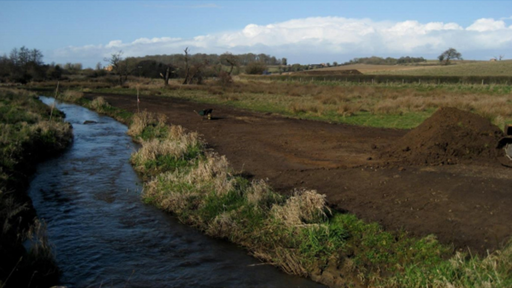
In 2017, the UK Environment Agency published the "Working with Natural Processes – Evidence Directory" which includes case studies on "Floodplain Wetland Restoration”. By restoring or creating floodplain wetlands close to river channels, this project aims to reduce flood risks and improve ecosystem services by increasing flood storage capacity. This was to be achieved by improving connectivity between the river and floodplains and maximizing the flood water that could be stored on floodplains; levees that hindered this connectivity were to be removed to effect this (Fig.). In 2009, a 400-meter section of embankment along the river Glaven was removed, making the riverbank the same height as the surrounding land. In 2010, land owners, environmental organizations, the Environment Agency, and research institutes collaborated to create a narrower and more geomorphically diverse and meandering channel to improve the habitat, ecosystem, and connectivity between the river and floodplain.
Outputs / Expected benefits
The removal of the embankment facilitated the inundation of adjacent riparian areas during minor flood events, resulting in widespread floodplain storage when the River Glaven rises (above 1.7m3/s) and flood peak (the highest flow level during a flood event) attenuation of up to 5%. In addition, environmental benefits were observed, such as higher groundwater levels due to infiltration during flooding, and an increase in plant diversity due to more frequent flooding of farmlands.