Climate change impacts
The land area to the west of Katsura River, from the Nishikyo and Minami Wards of Kyoto City, through the municipalities of Muko, and Nagaokakyo, has been historically subject to regular flooding. This is said to be one of the reasons why the capital was moved to Heian-kyo only 10 years after the construction of Nagaoka-kyo. In recent years, increasing urbanization has resulted in multiple instances of urban flooding, in which drainage systems are overwhelmed by high rainfall. The risk of increasing cases of extreme heavy rains due to climate change leading to greater urban flooding is therefore a matter of concern.
Adaptation activity
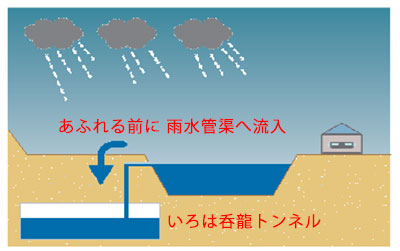
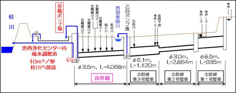
In FY1995, Kyoto Prefecture commenced the development of the "Iroha Donryu Subterranean Tunnel" (Fig. 1) as a measure against flooding in the aforementioned area. This facility prevents urban flood damage by providing heavy rain storage which drains into the Katsura River.
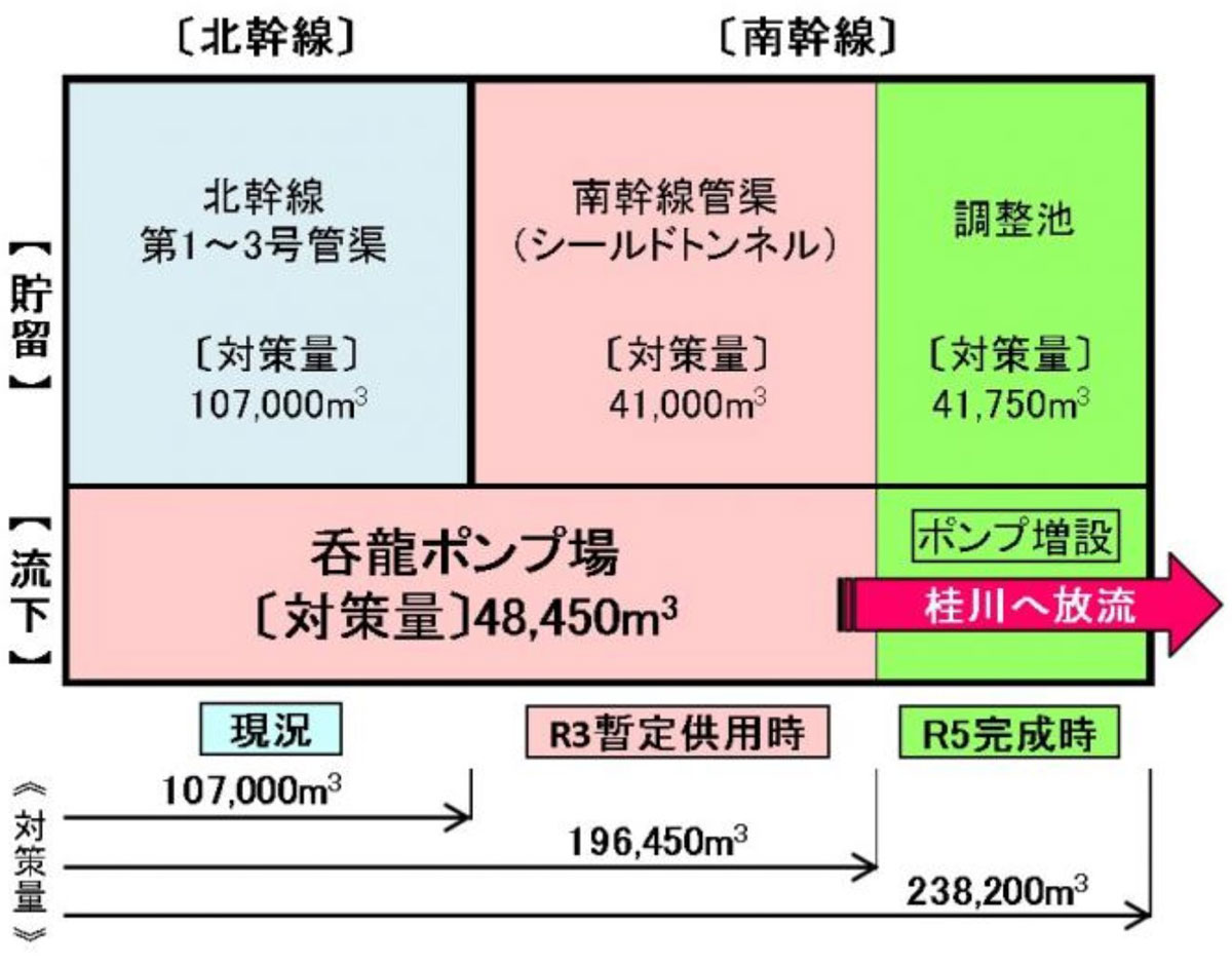
Between 2001 and 2011, three trunk lines were laid in the north of the target area, and put into service as they were completed, ultimately allowing the storage of up to 107,000 m3 of rainwater. In 2021, a southern trunk line and the Donryu Pump Station will be provisionally operational and able to drain water into the Katsura River at a rate of 10 cubic meters per second (Fig. 2). The entire facility is scheduled to be fully operational by 2023, and the total drainage capacity will be 238,200 cubic meters (Fig. 3).
Outputs / Expected benefits
In September 2013, Typhoon No. 18 caused an unprecedented heavy rain alert in Kyoto Prefecture, and flood damage subsequently occurred in various areas. The storage of the northern trunk line facility was filled to 100% capacity for the first time since the system had been put into operation, however, the number of houses damaged by flood water was only 106. In simulations, it was estimated that damage would have occurred in about 900 houses if the facility had not been developed, thereby indicating that Iroha Donryu tunnel could mitigate flooding damage considerably. When the entire facility is complete, the potential for flood damage caused by heavy rainfall to the extent caused by Typhoon No.18 (see Note) will be fully abated.
Footnote
(Note) rainfall: 275 mm, hourly maximum rainfall: 41 mmm