Climate Change Adaptation Information Platform(A-PLAT)
パソコンの検索マーク
携帯の検索マーク

Creation of disaster and evacuation cards

Publication date October 1, 2018
Sector Natural Disasters and Coastal Areas
Region name Chugoku-Shikoku(Ehime Prefecture)

Adaptation activity

Climate change is expected to exacerbate the issue of disasters caused by torrential rainfall. In response to this, the Office of the Cabinet is promoting the introduction of "Disaster and Evacuation Cards", which provide information on evacuation sites and other important guidance necessary in the event of emergency situations that are considered likely for the area in question. The distribution of "Disaster and Evacuation Cards" in advance of natural disasters is expected to enable more rapid evacuation when necessary.

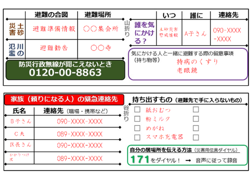
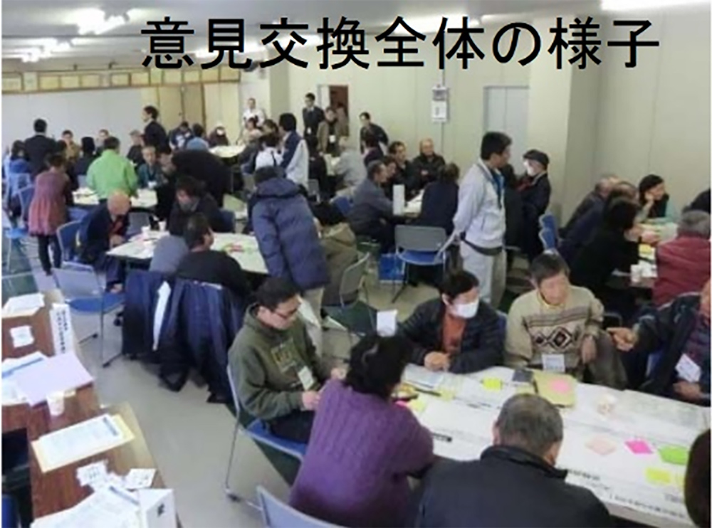
In FY2016, the Miyoshi district of Ōzu City, Ehime Prefecture, in the Hiji River Basin, was selected as one of the districts for the "Disaster and Evacuation Card Model Project" (see Note) by the Office of the Cabinet. The region has frequently been subject to flood damage. In addition, it is a large area for which evacuation is necessary for different types of hazards. In this model area, the Miyoshi district Disaster Mitigation Volunteers Association provided support and guidance for local residents to prepare "Disaster and Evacuation Cards" through workshops and other events. Cards were distributed to all households (Fig. 1), and evacuation drills and roundtable discussions were held on the basis of the information provided (Fig. 2).

Outputs / Expected benefits

During torrential rains in western Japan in July 2018, the Hiji river flooded, however, there were no casualties.

Note: The Office of the Cabinet’s "Disaster and Evacuation Card Model Project" is primarily led by volunteer organizations who organize the development of "Disaster and Evacuation Cards" with local residents through public meetings and workshops, and practicing emergency drills by walking through actual evacuation routes.

災害・避難カードの例
Fig. 1 Disaster and Evacuation Card used in the Miyoshi District
(Source: Council for Hiji River Flood Disaster Mitigation, Ōzu River and National Highways Office, Ministry of Land, Infrastructure, Transport and Tourism, Shikoku Regional Development Bureau: “Disaster and Evacuation Card Development Status”)
住民の意見交換の様子
Fig. 2 Residents’ meeting
(Source: Council for Hiji River Flood Disaster Mitigation, Ōzu River and National Highways Office, Ministry of Land, Infrastructure, Transport and Tourism, Shikoku Regional Development Bureau: “Disaster and Evacuation Card Development Status”)
Sources and Related Information
Council for Hiji River Flood Disaster Mitigation, Ōzu River and National Highways Office, Ministry of Land, Infrastructure, Transport and Tourism, Shikoku Regional Development Bureau: “Disaster and Evacuation Card Development Status”
http://www.skr.mlit.go.jp/oozu/kawa/ishiki_torikumi/torikumi_8.pdf
Cabinet Office, "FY2017 Revised Case Study of Disaster and Evacuation Cards"
http://www.bousai.go.jp/oukyu/hinankankoku/pdf/jireishuu.pdf

To the top