Adaptation activity
Workshops on hazard mitigation were held twice in 2016 in Yamaji district, Uda, Nara Prefecture. These were part of efforts to reach targets set out in the "Council on Mitigation for Large-scale Flood and Sediment-related Disasters" for the upper reaches of the Kizu River.
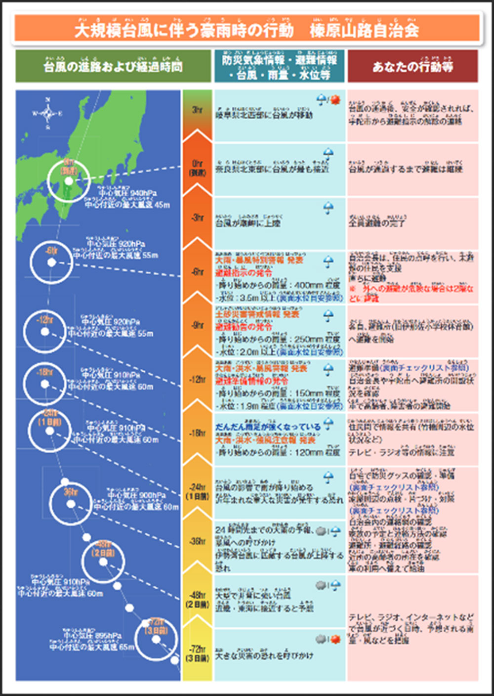
In the workshop, residents took the initiative in creating a disaster prevention map and creating a timeline in anticipation of a large-scale typhoon. The creation of a Timeline (Disaster Mitigation Action Plan) under the initiative of residents in anticipation of a complex disaster involving flood and sediment-related disasters was the first initiative within the jurisdiction of the (Ministry of Land, Infrastructure, Transport and Tourism) Upstream River Office of the Kizu River. In creating a disaster prevention map, residents carried out inspections while walking around the town (Fig. 1) and organized the collected information on a map. In the creation of the timeline, we also discussed items to be implemented, such as confirmation of rainfall conditions, anticipated damage, and evacuation actions, based on information such as typhoon conditions and weather gauge announcements. The timeline, which was completed by organizing the results of the study, was distributed to each resident (Fig. 2).